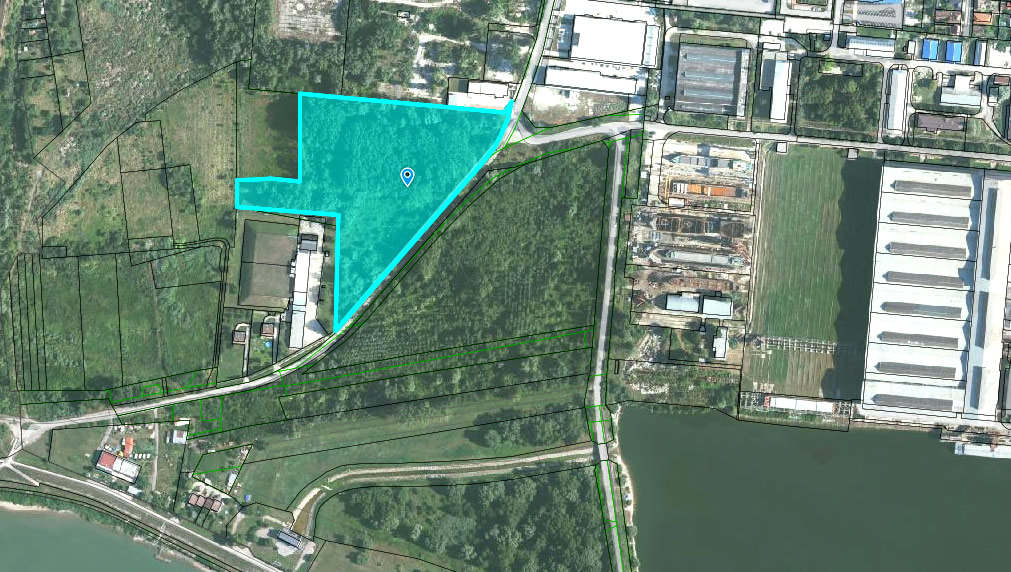
The property behind the shipyards offers excellent opportunities for water transportation. It is also close to the new bridge to be built over the Danube and to the main road to Bratislava.
1st part
Cadastral district: Komárno
Parcel No.: 3579
Number of ownership document: 6434
Area: 27853 m2
Type of property: forest land
Way of use: land with a forest, or temporarily without a forest but to be afforested, or land after random logging
Location: The property is located in an urban zone.
Category in the land use plan of the town: F1
Link:
GISplan KN:
http://mu-komarno.gisplan.sk/mapa/katastralna-mapa/?ly=ad,pc,pe,ul&lb=of-2014&c=-504246:-1330185.25&z=5&i=-504463.05:-1330083.24
Google Earth:
https://www.google.sk/maps/@47.7603457,18.095224,1054m/data=!3m1!1e3?hl=sk
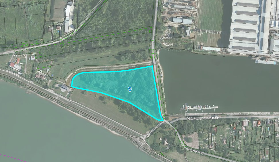
2nd part
Cadastral district: Komárno
Parcel No.: 3570
Number of ownership document: 6434
Area: 29256 m2
Type of property: other areas
Way of use: Land with rocks, slopes, ravines, potholes, lands with bushes or rocks and other lands that do not make steady profits
Location: The property is located in an urban zone.
Category in the land use plan of the town: E1
Link:
GISplan KN:
http://mu-komarno.gisplan.sk/mapa/katastralna-mapa/?ly=ad,pc,pe,ul&lb=of-2014&c=-504225.8:-1330419.45&z=5&i=-504352.04:-1330452.79
Google Earth:
https://www.google.sk/maps/@47.7594382,18.0926923,1054m/data=!3m1!1e3?hl=sk
Further information: Odbor správy majetku, Komárno, kontakty