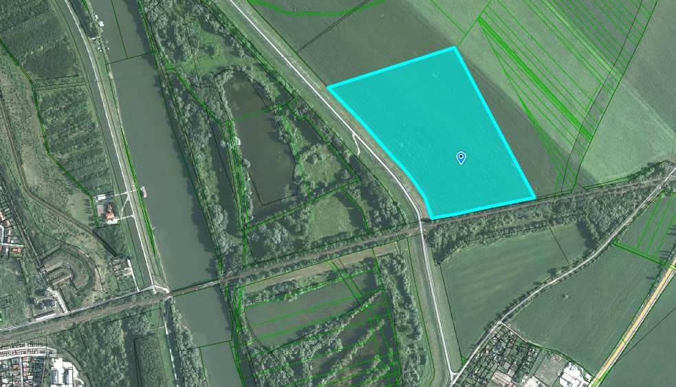
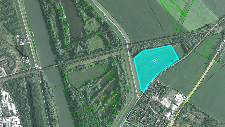
There are two properties near the road leading to Lándor and Kava. Both are owned by the municipality and are used as farmland at present. However, both properties can be transferred into industrial properties. They are within easy reach from the main roads and are located near the railway. The properties can be used as one property and separately as well.
1st part
Cadastral district: Komárno
Parcel No.: 12839/4
Number of ownership document: 6434
Area: 152197 m2
Type of property: arable land
Way of use: land used for crop production
Location: The property is located outside the urban zone
Category in the land use plan of the town: A1, C1, 2, D1, G1
Link:
GISplan KN:
http://mu-komarno.gisplan.sk/mapa/katastralna-mapa/?ly=ad,pc,pe,ul&lb=of-2014&c=-500080.35:-1328603.35&z=4&i=-500060.50:-1328819.08
Google Earth:
https://www.google.sk/maps/@47.7767847,18.1518216,2107m/data=!3m1!1e3?hl=sk
2nd part
Cadastral district: Komárno
Parcel No.: 12862
Number of ownership document: 6434
Area: 75272 m2
Type of property: arable land
Way of use: land used for crop production
Location: The property is located outside the urban zone
Category in the land use plan of the town: B2, F1
Link:
Google Earth:
https://www.google.sk/maps/@47.7717621,18.1462479,2107m/data=!3m1!1e3?hl=sk
Further information: Odbor správy majetku, Komárno, kontakty